

In order to deliver on its mandate – the release of suitable land for the creation of sustainable human settlements – the HDA developed a GIS or geographic information system tool called LaPsis (Land and Property Spatial Information System).
LaPsis is a land and property spatial information system accessible online that helps users to reference their own information with up-to-date human-settlement-sector information.
Users can search for properties and create maps using different spatial data sets. But LaPsis can do more than this. To further show our stakeholders what LaPsis can do, the HDA has introduced ‘Map of the Quarter’.
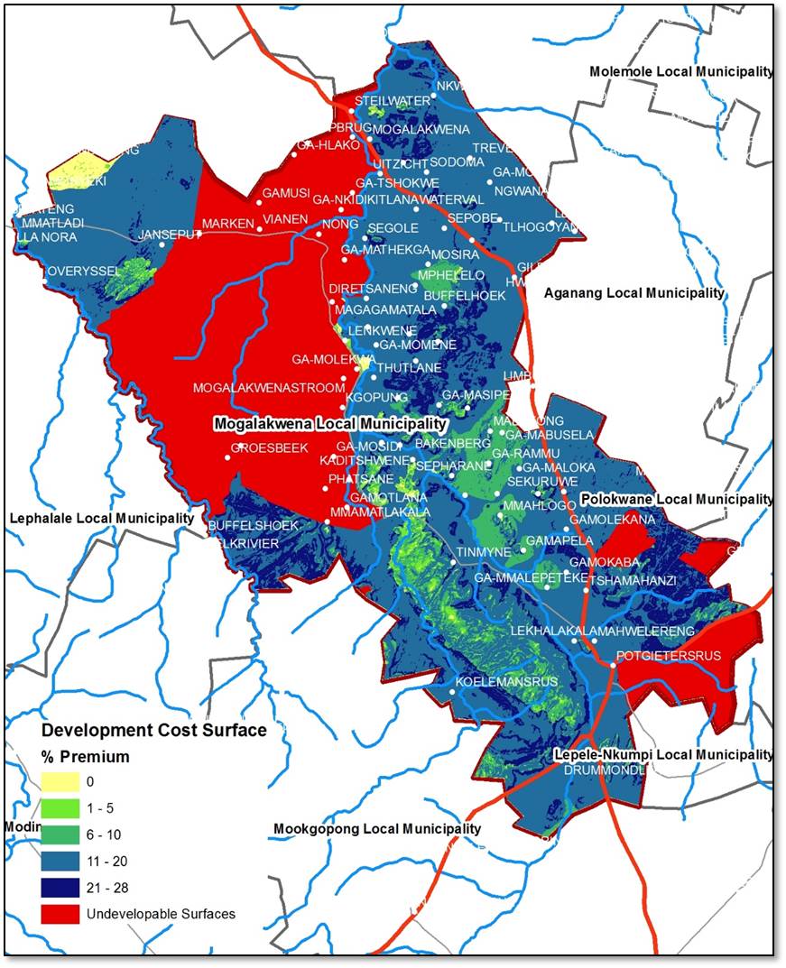
This quarter the map shows how vacant land within a municipality is often developed at a cost significantly higher than elsewhere. This cost surface map for the municipality will indicate the premium payable to develop land based on certain environmental and geological constraints.
The cost surface analysis will be made available for selected municipalities for the next round of municipal profiles that will be completed in the Northern Cape, Free State and Limpopo provinces.
(Source: i@consulting)