

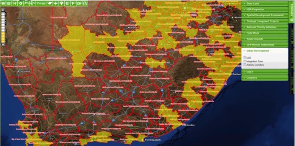
This quarter’s map addresses the Master Spatial Plan (MSP). The aim of the MSP is to direct human settlement planning initiatives to areas where investment would achieve the highest impact.
The attached LaPsis map shows municipalities (in yellow) that are considered as spatially prioritised for the MSP. These municipalities are prioritised because they are at least one of the following:
The HDA’s geospatial information services (GIS) enable us to identify, analyse and prioritise well-located land for release. This is primarily undertaken through our land and property spatial information system, LaPsis, which serves as a repository of all data on land and landed property in South Africa, including cadastre, ownership, title documents, deeds, administrative boundaries and points of interest. LaPsis is easy to use, freely available and widely employed by many provinces and municipalities. We have just finished producing a series of “How to use LaPsis” videos that will be posted on our website over the next few weeks.