

In order to deliver on its mandate – the release of suitable land for the creation of sustainable human settlements – the HDA developed a geographic information system (GIS) tool called LaPsis (Land and Property Information System).
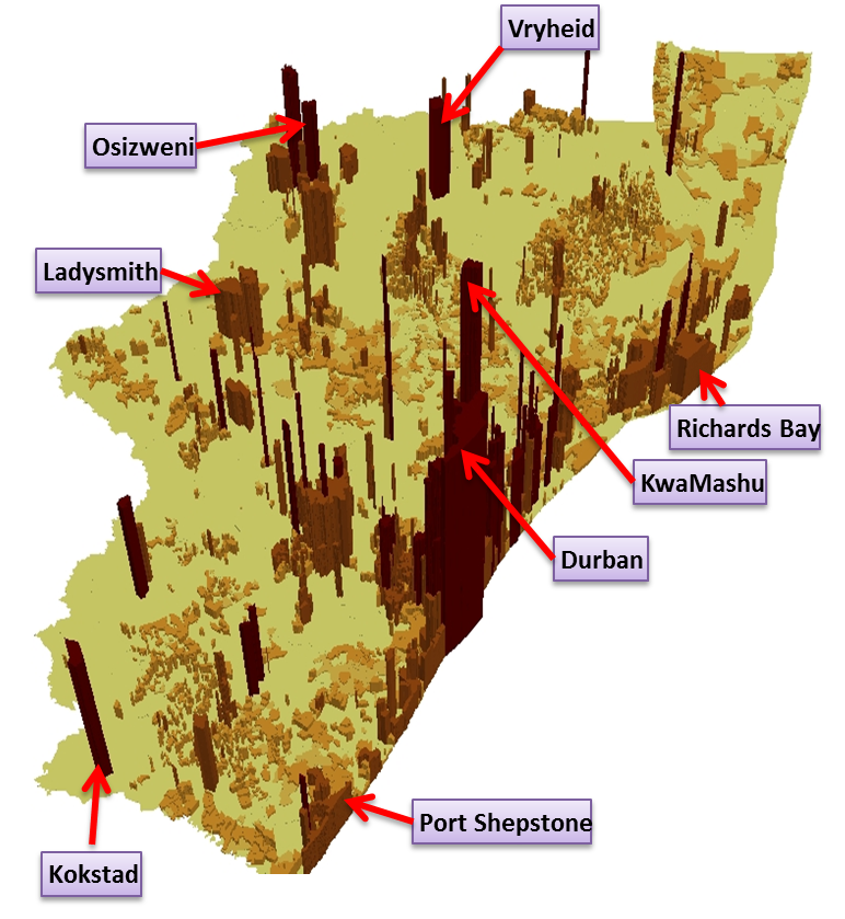
KwaZulu-Natal is the sixth regional office the HDA has been established in. To get a better understanding of the province, the Land Management and Information Systems (LMIS) produced a number of maps through LaPsis, of which population density is one.
The adjacent 3D population density map is an indication of the population of the province per square kilometre. The eThekwini Metropolitan area is the municipality with the highest population density in the province. KwaMashu is the main city with the highest population density, followed by Siyanda, Clermont, Durban and Umlazi.
For more information about our GIS services please contact hadley.remas@thehda.co.za or visit our website www.lapsis.co.za.